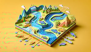
Ready to dive into drainage system geomorphology? Our free quiz is designed for earth-science enthusiasts eager to test their grasp of drainage patterns geomorphology and the various types of drainage systems carved by nature. You'll explore watershed drainage patterns as you tackle each question, from classic branch-like layouts to intricate network designs. Whether you've aced our river systems quiz before or this is your first taste of hydrology puzzles, you'll sharpen your knowledge and have fun doing it. Think you can master every pattern? Take action now, start the challenge and see how you stack up in this ultimate water quiz adventure!
What term describes the area of land where all precipitation collects and drains off into a common outlet?
Watershed
Base level
Stream order
Drainage density
A watershed, also known as a drainage basin, is the land area that channels precipitation to creeks, streams, and rivers, eventually reaching a common outlet. Watersheds are fundamental units in hydrology and geomorphology. Understanding a watershed's boundaries helps in water resource management and flood control. More details can be found at Wikipedia.
Which drainage pattern resembles the branches of a tree and is the most common form?
Radial
Trellis
Dendritic
Rectangular
The dendritic drainage pattern looks like the branches of a tree, with tributaries joining larger streams at acute angles. It forms over relatively homogeneous substrates with uniform resistance. This pattern is the most common because many landscapes lack strong structural controls on stream direction. See Wikipedia for more information.
What is the term for the imaginary line that separates one drainage basin from another?
Alluvial front
Confluence line
Drainage divide
Extreme contour
A drainage divide is the elevated boundary that separates neighboring drainage basins. Precipitation falling on either side of the divide will flow into different river systems. Divides can be subtle ridge lines or major mountain ranges like the Continental Divide in North America. Learn more at Wikipedia.
Which factor primarily influences the development of a trellis drainage pattern?
Alternating rock resistance due to folding or tilting
High vegetation density
Low annual precipitation
Uniform soil permeability
Trellis drainage develops where sedimentary rock layers are folded or tilted, creating alternating bands of resistant and weak strata. Streams run parallel along the weak layers and then turn sharply to join the main channel at right angles. This pattern is common in folded mountain belts. More details are available at Wikipedia.
In the Strahler stream ordering system, what order is given when two second-order streams join?
Second-order
Third-order
First-order
Fourth-order
According to the Strahler method, when two streams of the same order join, the resulting downstream segment increases by one order. Thus, two second-order streams combine to form a third-order stream. If streams of different orders join, the higher order is maintained. You can read more at Wikipedia.
How is drainage density of a basin defined?
Total basin area divided by the length of the main channel
Average slope of the stream channels
Total length of streams divided by the basin area
Perimeter of the basin divided by the number of streams
Drainage density is calculated by dividing the total length of all streams and rivers in a drainage basin by the total area of the basin. It is expressed in units such as km/km² and reflects how dissected the landscape is. High values indicate closely spaced channels, often due to impermeable surfaces or steep slopes. More information at Wikipedia.
Which drainage pattern is typically found on a symmetrical volcanic cone?
Parallel
Radial
Trellis
Rectangular
Radial drainage patterns form when streams flow outward from a central high point, such as a volcanic cone or dome. Channels radiate in all directions like spokes on a wheel. This reflects uniform lithology and symmetrical topography. Additional details at Wikipedia.
A drainage basin has very high drainage density. What does this usually indicate about the terrain?
Dense forest cover and low runoff
Dry climate with minimal rainfall
Flat terrain with highly permeable soils
Steep slopes and impermeable or resistant surface material
High drainage density suggests a dense network of streams closely spaced, often found in areas with steep slopes and impermeable or resistant bedrock. It implies rapid surface runoff and limited infiltration. In contrast, permeable surfaces and gentle slopes tend to produce low drainage densities. See Fieldwork for more.
How does lithology influence the development of drainage patterns in a region?
By determining only the chemical composition of river water
By controlling rock permeability and structural orientation of joints and faults
Only by the prevailing climate conditions
Solely by the amount of organic material in soil
Lithology affects drainage patterns because different rock types vary in resistance to erosion and permeability. Structural features like joints and faults guide stream alignment. For example, resistant rock layers may form ridges that deflect streams, while softer rocks erode to form valleys. More on this topic at ScienceDirect.
What does a convex hypsometric curve suggest about the erosional stage of a basin?
It is in a late (old age) stage with low relief
It is in an early (youthful) stage of development
It has reached maturity with balanced erosion
It indicates tectonic stability with no erosion
A convex hypsometric curve, where most area lies at high elevations relative to the maximum relief, indicates a basin in its youthful or early erosional stage. Such basins have not yet undergone significant lowering of the landscape. Mature basins produce more S-shaped curves, while old-stage basins show concave curves. See Wikipedia.
Which change is typically observed in the hydrograph of a basin after significant urbanization?
A longer lag time and lower peak discharge
No change in the shape of the hydrograph
A steeper rising limb and a higher peak discharge
Increased baseflow and reduced peak discharge
Urbanization increases impervious surfaces like roads and roofs, reducing infiltration and accelerating runoff. This leads to a hydrograph with a steeper rising limb and a higher, sharper peak discharge. The lag time between rainfall and peak flow shortens. For more detail, see Wikipedia.
Which flow direction algorithm assigns flow from each cell to only its steepest downslope neighbor in DEM-based hydrologic modeling?
Pit Fill without flow assignment
D? (D-Infinite)
Multiple Flow Direction (MFD)
D8
The D8 (eight-direction) algorithm routes flow from each grid cell to the single adjacent neighbor with the steepest downward slope, creating a network of flow paths. While simple and widely used, it can result in unrealistic channelization in flat areas. More advanced methods like D? distribute flow over multiple directions. Learn more at Wikipedia.
0
{"name":"What term describes the area of land where all precipitation collects and drains off into a common outlet?", "url":"https://www.quiz-maker.com/QPREVIEW","txt":"What term describes the area of land where all precipitation collects and drains off into a common outlet?, Which drainage pattern resembles the branches of a tree and is the most common form?, What is the term for the imaginary line that separates one drainage basin from another?","img":"https://www.quiz-maker.com/3012/images/ogquiz.png"}
Score0/12
Easy0/4
Medium0/4
Hard0/3
Expert0/1
AI Study Notes
Email these to me
You can bookmark this page to review your notes in future, or fill out the email box below to email them to yourself.
Study Outcomes
Understand Core Principles of Drainage System Geomorphology -
Gain a clear grasp of how water pathways shape landscapes and the fundamental concepts behind drainage system geomorphology.
Identify Major Drainage Patterns in Geomorphology -
Recognize common drainage patterns geomorphology such as dendritic, radial, and trellis systems and understand their formation processes.
Differentiate Types of Drainage Systems -
Compare and contrast the main types of drainage systems, including exorheic, endorheic, and arheic networks, to see how they manage water flow.
Analyze Watershed Drainage Patterns -
Examine watershed drainage patterns by evaluating factors like slope, soil, and climate to determine their impact on river network development.
Apply Concepts with a River Drainage System Quiz -
Test your understanding through our interactive river drainage system quiz, applying key terms and concepts in real scenarios.
Evaluate Geomorphological Influences on River Networks -
Assess how geological structures, landforms, and tectonic activity influence the evolution and behavior of river drainage systems.
Cheat Sheet
Fundamentals of Drainage System Geomorphology -
Drainage system geomorphology explores how river networks shape landscapes under the influence of climate, geology, and slope (USGS). Recognizing these factors boosts your understanding of watershed evolution and flood risk. A handy mnemonic "CGS" (Climate-Geology-Slope) helps recall the three main controls.
Common Drainage Patterns Geomorphology -
Drainage patterns geomorphology classifies networks into dendritic, radial, rectangular, and trellis forms based on substrate and structure (Strahler, 1952). For example, dendritic systems look like tree branches, while radial drains flow outward from a central high point. Try the mnemonic "DRaRT" (Dendritic, Radial, Rectangular, Trellis) to memorize the four classic types.
Horton's Laws and Stream Ordering -
Horton's Laws describe stream hierarchy: the Law of Stream Numbers (Nu∝R−u) and the Law of Stream Lengths (Lu∝Ru) relate order u to network geometry. Using Strahler ordering, you assign the highest order when two streams of equal rank merge. This system underpins many river drainage system quiz questions!
Calculating Watershed Drainage Patterns -
Watershed drainage patterns are quantified using drainage density (Dd=ΣL/A), where ΣL is total channel length and A is basin area (Horton, 1932). High Dd (>5 km/km²) indicates rapid runoff and low infiltration, while low Dd (<2 km/km²) suggests permeable ground. Keep Dd handy when tackling watershed drainage patterns in exams.
Types of Drainage Systems Explained -
There are four main types of drainage systems: exorheic (open to the sea), endorheic (closed basins), arheic (no defined channels), and cryptorheic (subterranean flow). Exorheic basins discharge to oceans, whereas endorheic lakes (e.g., the Caspian Sea) trap water inland. A quick phrase "EEC²" (Exorheic, Endorheic, Cryptorheic, Arheic) helps lock them in memory.