Unlock hundreds more features
Save your Quiz to the Dashboard
View and Export Results
Use AI to Create Quizzes and Analyse Results

Sign inSign in with Facebook
Sign inSign in with Google

Test Your River Systems Knowledge - Take the Quiz!

Think you can ace this river trivia? Dive into the watershed quiz now!

Difficulty: Moderate
2-5mins
Learning OutcomesCheat Sheet
Paper art illustration showing winding river through layered watersheds fish and water plants on golden yellow background

Ready for a refreshing challenge? Our river systems quiz is perfect for nature lovers, geography buffs, and curious minds eager to test their river trivia facts and master river anatomy questions. You'll explore how watersheds shape landscapes, dive into a freshwater ecosystem quiz, and uncover the secrets of flowing waterways. Along the way, you'll discover how freshwater systems support biodiversity and take a fun watershed quiz to spot features like oxbow lakes and delta formations. Curious to see how you rank? Check out our trivia about rivers for mind-blowing questions, then jump into this exciting river quiz - your gateway to becoming a true river expert. Click "Start" now and let the currents of knowledge carry you away!

Which river is commonly regarded as the longest river in the world?
Amazon River
Mississippi River
Nile River
Yangtze River
The Nile River, flowing through northeastern Africa, is generally cited as the longest river in the world at about 6,650 kilometers long. While some measurements give the Amazon River a comparable length, the Nile remains the most widely recognized longest river by many hydrologists. The debate continues due to differing measurement techniques, but the Nile is still commonly listed first. https://en.wikipedia.org/wiki/Nile
What term refers to the beginning or source of a river?
Mouth
Headwaters
Tributary
Delta
The headwaters are the streams or springs that form the source of a river, often found in highland or mountainous regions. This is where water first collects and begins to flow downstream, marking the river's start. Headwaters are crucial for providing continuous flow and are influenced by precipitation and groundwater inputs. https://en.wikipedia.org/wiki/Headwaters
What is the landform called where a river deposits sediment as it flows into another body of water?
Floodplain
Estuary
Delta
Oxbow Lake
A delta forms at the mouth of a river where it slows down and deposits sediment into another body of water, such as an ocean or a lake. The sediment builds up over time to create distinct landforms that often have fertile soils. Deltas can take various shapes - bird's foot, arcuate, or cuspate - depending on water flow and sediment load. https://en.wikipedia.org/wiki/Delta_(landform)
A tributary is a smaller stream that flows into a larger river.
True
False
A tributary is defined as a stream or river that joins a larger stream or main stem river, contributing additional water and sediment. Tributaries increase the drainage network's complexity and help drain a larger watershed area. They play a key role in distributing flow and nutrients throughout the river system. https://en.wikipedia.org/wiki/Tributary
What is the term for the flat area adjacent to a river that periodically floods?
Delta
Watershed
Floodplain
Riparian Zone
A floodplain is the relatively flat area of land alongside a river that is subject to periodic flooding when river levels rise. Floodplains are important for nutrient deposition, wildlife habitat, and natural flood management. They are often highly fertile and used for agriculture but must be managed to reduce flood risk. https://en.wikipedia.org/wiki/Floodplain
Which term describes the land area drained by a river and its tributaries?
Estuary
Floodplain
Delta
Watershed
A watershed, or drainage basin, is the land area where all precipitation collects and drains off into a common outlet such as a river, bay, or other body of water. Watersheds can range in size from small local basins to large continental-scale systems. Understanding watersheds is crucial for water resource management and flood control. https://en.wikipedia.org/wiki/Drainage_basin
Which drainage pattern resembles the branching pattern of a tree?
Radial
Trellis
Rectangular
Dendritic
A dendritic drainage pattern develops on relatively uniform material where the river channels follow the path of least resistance, creating a tree-like branching network. It is the most common drainage pattern and indicates homogeneous substrate without significant structural control. https://en.wikipedia.org/wiki/Dendritic_drainage_pattern
What process describes the downward movement of water through soil and rock layers into groundwater?
Transpiration
Runoff
Percolation
Evaporation
Percolation refers to the movement of water downward through the soil and porous rock layers into the groundwater system. It is a critical part of the hydrologic cycle, replenishing aquifers and maintaining baseflow in rivers. Percolation rates depend on soil type, saturation, and geological structure. https://en.wikipedia.org/wiki/Percolation
In a hydrograph, what does 'baseflow' represent?
Evaporation from the channel
Surface runoff from storms
Groundwater discharge into the stream
Direct rainfall on the stream
Baseflow is the portion of streamflow sustained between precipitation events, fed to the river by delayed pathways such as groundwater discharge. It maintains river flow during dry periods and is critical for aquatic ecosystems. Hydrographs separate baseflow from quickflow to analyze watershed response. https://en.wikipedia.org/wiki/Baseflow
Which zone of a river is characterized by active sediment transport with minimal deposition?
Zone of Deposition
Zone of Transportation
Zone of Erosion
Transition Zone
The zone of transportation is the middle portion of a river system where energy is sufficient to carry sediment downstream but not to erode significant amounts from the channel. Deposition is minimal, and sediment load is transported from the headwaters toward the mouth. This zone often features well-developed meanders. https://en.wikipedia.org/wiki/River_profile
What depositional feature forms on the inside bend of a meandering river?
Floodplain
Point Bar
Cut Bank
Oxbow Lake
A point bar is a depositional feature that accumulates sediment on the inside bend of a meander where water velocity is lower. Over time, the buildup of sand and gravel creates a gently sloping bar. Opposite the point bar is the cut bank, where erosion is most intense. https://en.wikipedia.org/wiki/Meander
What term refers to the lowest elevation to which a river can erode its bed?
Ground Level
Base Level
Flood Stage
Erosion Limit
Base level is the theoretical limit below which a river cannot erode its channel. The ultimate base level is sea level, though local base levels can be created by resistant rock layers or lakes. Rivers adjust their profiles in response to changes in base level. https://en.wikipedia.org/wiki/Base_level
How is drainage density defined?
Total stream length divided by basin area
Basin perimeter divided by total stream length
Basin area divided by total stream length
Longest stream length divided by basin perimeter
Drainage density is calculated by dividing the total length of all streams and rivers in a drainage basin by the area of the basin. It reflects how dissected the landscape is by channels and influences runoff and infiltration. High drainage density indicates rapid runoff and lower infiltration potential. https://en.wikipedia.org/wiki/Drainage_density
What valley shape is typically carved by river erosion?
Hanging Valley
Box-shaped Valley
V-shaped Valley
U-shaped Valley
Rivers erode the landscape primarily downward and laterally, creating a characteristic V-shaped valley profile. The steep sides and narrow bottom reflect active channel incision and mass wasting on the valley walls. Glacial valleys, in contrast, are typically U-shaped. https://en.wikipedia.org/wiki/Valley
Which ecological concept emphasizes the lateral exchange of nutrients and organisms between a river and its floodplain during flooding?
River Continuum Concept
River Network Concept
Serial Discontinuity Concept
Flood Pulse Concept
The Flood Pulse Concept describes how seasonal flooding connects a river channel to its floodplain, facilitating the exchange of nutrients, organic matter, and organisms. These lateral movements are critical for maintaining high productivity and biodiversity in floodplain ecosystems. It contrasts with the longitudinal focus of the River Continuum Concept. https://en.wikipedia.org/wiki/Flood_pulse_concept
According to Strahler stream order, what is the resulting order when a third-order stream is joined by a second-order stream?
2
4
5
3
In the Strahler stream ordering system, the order increases only when two streams of the same order merge. When a third-order stream is joined by a lower second-order stream, the order remains third. Only the confluence of two third-order streams would create a fourth-order stream. https://en.wikipedia.org/wiki/Strahler_number
0
{"name":"Which river is commonly regarded as the longest river in the world?", "url":"https://www.quiz-maker.com/QPREVIEW","txt":"Which river is commonly regarded as the longest river in the world?, What term refers to the beginning or source of a river?, What is the landform called where a river deposits sediment as it flows into another body of water?","img":"https://www.quiz-maker.com/3012/images/ogquiz.png"}

Study Outcomes

  1. Understand Watershed Concepts -

    Understand how watersheds channel precipitation into river systems and distinguish between drainage basins in this river systems quiz.

  2. Identify River Anatomy -

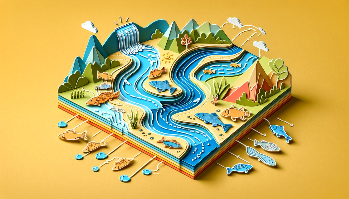
    Identify the main parts of a river channel, including source, tributaries, meanders, and deltas, to reinforce river anatomy questions.

  3. Analyze Freshwater Ecosystems -

    Analyze key components of freshwater ecosystems, exploring how flora and fauna interact with river flow and water quality.

  4. Apply River Trivia Facts -

    Apply interesting river trivia facts to answer challenging questions and boost your general knowledge of rivers worldwide.

  5. Evaluate Watershed Quiz Scenarios -

    Evaluate real-world watershed quiz scenarios to predict how changes in land use or climate can alter river behavior and health.

  6. Interpret River Flow Processes -

    Interpret variations in river discharge and sediment transport, enabling you to predict outcomes like flooding or channel formation.

Cheat Sheet

  1. Watershed and Drainage Basin Basics -

    Every river system starts with a watershed or drainage basin, the land area that channels rainfall into streams and rivers. Remember the mnemonic "Divide to Decide" to recall that watershed divides determine where water flows - critical for any watershed quiz question. Review topographic maps from USGS or similar academic sources to practice delineating your own watershed.

  2. River Discharge Calculation (Q = A × V) -

    Discharge (Q) measures the volume of water flowing past a point per second, using the formula Q = A × V, where A is cross-sectional area and V is velocity. A simple float-and-watch method (timing a drifting object) helps estimate V in field conditions, a classic trick in river systems quiz labs. Make sure to convert units consistently (m² × m/s = m³/s) when solving river anatomy questions.

  3. Channel Morphology: Meandering vs. Braided -

    Rivers evolve through stages from straight to meandering or braided channels based on slope, sediment load and bank material. Use the "YOMS" mnemonic - Young, Old, Meandering, Straight - to recall how slope and sediment size shape channel patterns. Compare aerial photos from academic journals to spot these features and ace those river trivia facts challenges.

  4. Freshwater Ecosystem Zones -

    Rivers exhibit distinct ecological zones: the headwaters (cold, oxygen-rich), mid-reach (moderate flow), and lower reach (slower, warmer water). The River Continuum Concept (RCC) helps predict how organic matter and organisms change downstream - perfect prep for a freshwater ecosystem quiz. Sketch a longitudinal profile and label each zone to lock in these key ecosystem transitions.

  5. Sediment Transport and the Hjulström Curve -

    The Hjulström curve illustrates the critical velocity needed to erode, transport, or deposit particles of different sizes. Remember "Fine requires fast, coarse requires coarser" to recall that clay needs surprisingly high velocity to erode, while gravel settles quickly. Consult hydro-sediment transport studies from universities to practice reading and interpreting this foundational graph for river systems quiz success.

Powered by: Quiz Maker