Unlock hundreds more features
Save your Quiz to the Dashboard
View and Export Results
Use AI to Create Quizzes and Analyse Results

Sign inSign in with Facebook
Sign inSign in with Google
Quizzes > High School Quizzes > Social Studies

Geobee Practice Quiz for Exam Success

Enhance exam skills with interactive review questions

Difficulty: Moderate
Grade: Grade 6
Study OutcomesCheat Sheet
Colorful paper art promoting GeoBee Genius Challenge, a geography quiz for middle schoolers.

Which continent is the largest by land area?
Asia
Antarctica
Europe
Africa
Asia is the largest continent by land area, spanning both Eastern and Western hemispheres. With a diverse range of cultures and climates, it plays a crucial role in global geography.
Which river is traditionally considered the longest in the world?
Mississippi River
Amazon River
Nile River
Yangtze River
The Nile River is traditionally recognized as the longest river, flowing through northeastern Africa. This fact is widely accepted in geography studies and is frequently cited in educational texts.
Which ocean is the largest on Earth?
Indian Ocean
Pacific Ocean
Atlantic Ocean
Arctic Ocean
The Pacific Ocean is the largest ocean, covering an extensive area and significantly influencing global climate patterns. Its vast size makes it a key subject of study in geography.
In which direction does the sun rise?
West
East
South
North
The sun reliably rises in the east due to Earth's rotation on its axis. This basic geographical fact is one of the first concepts taught in geography.
How many continents are there on Earth?
7
6
8
5
There are 7 continents in the world, each with distinct geographical and cultural attributes. This basic fact is fundamental to understanding global geography.
What imaginary line divides the Earth into the Northern and Southern Hemispheres?
Tropic of Cancer
Equator
Tropic of Capricorn
Prime Meridian
The Equator is the imaginary line at 0° latitude that splits the Earth into Northern and Southern Hemispheres. It is a fundamental concept in geography and is used to describe climate zones.
Which is the largest non-polar desert in the world?
Arabian Desert
Gobi Desert
Sahara Desert
Kalahari Desert
The Sahara is the largest non-polar desert, spanning a large area of North Africa with its arid environment. Its size and climatic conditions make it a prominent feature in world geography.
Which country is known to have the most natural lakes?
United States
Brazil
Russia
Canada
Canada boasts more natural lakes than any other country due to its vast glacial history and diverse geography. This abundance of lakes plays a key role in Canadian geography and ecology.
What does the International Date Line determine?
The division between the hemispheres
The location of the equator
The starting point for measuring latitude
The change of calendar day
The International Date Line demarcates where one calendar day ends and the next begins. It is vital for keeping time consistent across the globe.
What is the primary cause of seasonal changes on Earth?
The shape of Earth's orbit
Earth's distance from the sun
The tilt of Earth's axis
Ocean currents
The tilt of Earth's rotational axis leads to varying sun exposure throughout the year, resulting in different seasons. This axial tilt is a central reason for seasonal weather changes.
Which country is located on the Iberian Peninsula?
Germany
Spain
France
Italy
Spain, along with Portugal, is located on the Iberian Peninsula in southwestern Europe. This geographical region is significant in European history and cultural studies.
What is the longest mountain range in the world?
Andes
Himalayas
Rockies
Alps
The Andes, stretching along South America's western edge, is the longest continental mountain range in the world. Its extensive formation affects weather and climate across the region.
Which U.S. state is nicknamed the 'Sunshine State'?
California
Arizona
Florida
Texas
Florida is known as the 'Sunshine State' due to its warm climate and high number of sunny days. This nickname reflects its climate and tourist appeal.
Which continent is unique as both a continent and an island?
Greenland
Australia
Antarctica
Africa
Australia is both a continent and an island, the only landmass that fits both criteria. Its isolation and size make it a fascinating subject in geographical studies.
What term describes a large body of air with uniform temperature and humidity?
Anticyclone
Front
Air mass
Cyclone
An air mass is a sizable body of air that maintains similar temperature and moisture characteristics across its extent. Its study is essential for understanding weather patterns.
Which country is known as a transcontinental nation, with territory in both Asia and Europe?
India
China
Turkey
Brazil
Turkey is geographically positioned with a small portion in southeastern Europe and the majority in Asia, making it transcontinental. This unique positioning impacts cultural and political dynamics.
What is the significance of the Prime Meridian in geospatial measurements?
It measures the distance from the Equator
It divides the Earth into the Eastern and Western hemispheres
It is the primary determinant of time zones worldwide
It serves as the zero degree longitude line, essential for navigation
The Prime Meridian is the reference line for measuring longitude and serves as the baseline for global navigation and mapping. Its role is critical in establishing accurate geospatial coordinates.
Which ancient Peruvian site is renowned for its sophisticated terraced agriculture and is a UNESCO World Heritage site?
Machu Picchu
Cusco
Lima
Nazca
Machu Picchu is celebrated for its ingenious terraced farming which allowed the Inca to maximize arable land on mountainous terrain. Its architectural and agricultural achievements contribute to its UNESCO designation.
What geographic phenomenon is responsible for the creation of a rain shadow effect?
Mountain ranges obstructing moist air
Large bodies of water
Proximity to deserts
Coastal cliffs
When moist air is forced to rise over mountain ranges, it cools and precipitates on the windward side, leaving the leeward side dry, known as a rain shadow. This phenomenon is crucial in understanding regional climate variations.
Which planet features the highest volcano and a vast canyon system, making it a subject of geological interest?
Mars
Jupiter
Venus
Mercury
Mars is home to Olympus Mons, the tallest volcano, and Valles Marineris, one of the largest canyon systems in the solar system. These features make Mars a focal point for comparative planetology studies.
0
{"name":"Which continent is the largest by land area?", "url":"https://www.quiz-maker.com/QPREVIEW","txt":"Which continent is the largest by land area?, Which river is traditionally considered the longest in the world?, Which ocean is the largest on Earth?","img":"https://www.quiz-maker.com/3012/images/ogquiz.png"}

Study Outcomes

  1. Understand key geographical concepts and terminology.
  2. Analyze maps and spatial data to determine location-based relationships.
  3. Apply geographic knowledge to solve real-world problems.
  4. Evaluate cultural and physical features across different regions.
  5. Interpret data and visual information to make informed conclusions.
  6. Enhance test-taking strategies and build confidence for examinations.

Geobee Quiz: Review & Practice Cheat Sheet

  1. Five Themes of Geography - These five themes create a fun toolkit for exploring the world's patterns and processes. From pinpointing a location to defining a region, they make geography a breeze. Five Themes of Geography
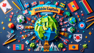
  2. World Capitals - Mastering capitals turns map study into an exciting trivia challenge and boosts your political geography skills. Recall Paris, Tokyo, or Canberra on demand and impress your friends! Ducksters Geography Questions
  3. Major Physical Features - Mountains, rivers, and deserts shape our planet and its climates, so spotting them sharpens your Earth-savvy radar. Explore landmarks like the Himalayas or the Sahara to see geography in action. WFKB Geography Site
  4. Latitude and Longitude - These imaginary lines form the coolest global grid, helping you zero in on any spot worldwide. Mastering them feels like unlocking a secret map code! Latitude and Longitude
  5. Climate Zones - From steamy tropical heat to frosty polar chills, climate zones influence how people live, what plants grow, and where animals roam. Discover how these zones shape agriculture, fashion, and daily life! Climate Zones
  6. Human-Environment Interaction - Learn how people adapt to and transform their surroundings, from skyscrapers to sustainable farms. It's geography in motion as we build dams, plant forests, and create eco-solutions. Human-Environment Interaction
  7. Map Reading Skills - Dive into political, physical, and thematic maps to decode symbols, scales, and legends. Reading maps is like solving a puzzle - each piece reveals new geographic secrets. Map Types Guide
  8. Continents and Oceans - Get to know Earth's giant landmasses and bodies of water, from Asia's peaks to the Pacific's depths. This global tour lays the foundation for all your geography adventures. Continents and Oceans
  9. Population Distribution - Why do cities sprout by rivers while deserts stay empty? Population patterns uncover how resources, climate, and opportunity influence where we live. Population Distribution
  10. Key Geographic Terms - Archipelago, delta, isthmus - these power-up your geography vocabulary and help you describe landforms with flair. Learn them to sound like a true cartography champ! Geographic Terms Glossary
Powered by: Quiz Maker