Unlock hundreds more features
Save your Quiz to the Dashboard
View and Export Results
Use AI to Create Quizzes and Analyse Results

Sign inSign in with Facebook
Sign inSign in with Google

Asia Map Quiz: Can You Name Every Country?

Think you can ace this map of Asia quiz? Dive in and spot every Asian country!
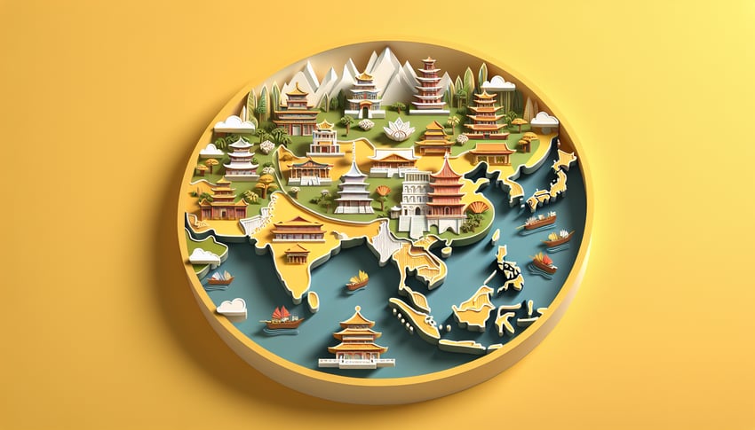
Difficulty: Moderate
2-5mins
Learning OutcomesCheat Sheet
Paper art illustration for Asia map quiz on a golden yellow background

Got a passion for maps and a hunger to learn? Our asia map quiz is the ultimate playground for geography fans, students, and curious travelers! With each question in this asia quiz, you'll pinpoint capitals, borders and hidden gems across the continent, while sharpening skills for real-world exploration. You can use this detailed quiz on asia map to tackle every challenge head-on, or test your regional savvy with the fun Asian map quiz . Along the way, pick up fun facts about culture and geography in this asia geography quiz. Challenge yourself today - start the map of asia quiz to see if you can ace every question and unlock new geographic insights!

Which country is the largest by land area in Asia?
India
Kazakhstan
Russia
China
Russia covers about 17 million square kilometers, making it the largest country not only in Asia but in the world. A large part of its territory lies in Siberia and the Russian Far East, well within the Asian continent. China ranks second in Asia by area, followed by India and Kazakhstan. Britannica: Russia
Which of these is an island nation in Asia with no land borders?
Nepal
Japan
Uzbekistan
Bangladesh
Japan is an archipelago consisting of more than 6,800 islands in the Pacific Ocean and shares no land borders with other countries. Bangladesh borders India and Myanmar, Uzbekistan is landlocked in Central Asia, and Nepal borders India and China. Wikipedia: Islands of Japan
Which Southeast Asian country is completely landlocked?
Cambodia
Laos
Thailand
Vietnam
Laos is the only landlocked country in Southeast Asia, bordered by China, Vietnam, Cambodia, Thailand, and Myanmar. Cambodia, Thailand, and Vietnam all have coastlines on the Gulf of Thailand or the South China Sea. Britannica: Laos
Which country has the highest population in Asia?
Indonesia
China
Pakistan
India
China is the most populous country in Asia and the world, with over 1.4 billion people. India follows closely and may surpass China in the coming years, while Indonesia and Pakistan rank third and fifth globally. Worldometers: China Population
Which country is nicknamed the "Land of the Rising Sun"?
Japan
Thailand
China
South Korea
Japan's name in Japanese (Nippon) literally means "origin of the sun," often translated as "Land of the Rising Sun." This nickname reflects its eastern position relative to the Asian continent. South Korea, China, and Thailand have different historical epithets. Britannica: Japan
Which Asian country shares land borders with the most other countries?
India
Russia
China
Kazakhstan
China has land borders with 14 countries, the most of any country in Asia: Afghanistan, Bhutan, India, Kazakhstan, Kyrgyzstan, Laos, Mongolia, Myanmar, Nepal, North Korea, Pakistan, Russia, Tajikistan, and Vietnam. Russia also borders 14 nations but is partially in Europe. World Atlas: China Borders
Which is the smallest sovereign country in Asia by land area?
Brunei
Bahrain
Singapore
Maldives
The Maldives is the smallest Asian country by land area, totaling about 298 square kilometers across its atolls. Bahrain is the second smallest, Brunei and Singapore are larger. CIA World Factbook: Maldives
Which country borders both the Caspian Sea and the Persian Gulf?
Saudi Arabia
Iraq
Kuwait
Iran
Iran has coastlines on both the Caspian Sea to its north and the Persian Gulf to its south. Saudi Arabia and Kuwait border only the Persian Gulf, while the Caspian Sea is bordered by Iran, Russia, Kazakhstan, Turkmenistan, and Azerbaijan. Britannica: Iran
Which of these countries does NOT share a land border with India?
Nepal
Pakistan
Myanmar
Sri Lanka
Sri Lanka is separated from India by the Palk Strait and does not share a land border. India shares land borders with Pakistan, Nepal, Myanmar, Bangladesh, Bhutan, China, and Afghanistan (through a narrow corridor). Britannica: India
Which Southeast Asian country has exactly one land border with another country?
Indonesia
Thailand
Singapore
Vietnam
Singapore is connected to Malaysia by a single causeway and shares only that one land border. Indonesia has land borders with Papua New Guinea and Malaysia, Thailand borders several countries, and Vietnam borders multiple neighbors. CIA World Factbook: Singapore
The Ural Mountains, often cited as the boundary between Europe and Asia, are located primarily in which country?
Mongolia
Uzbekistan
Russia
Kazakhstan
The Ural Mountains stretch north - south through western Russia from the Arctic to the Ural River. They are generally considered the dividing line between the continents of Europe and Asia. They do not run through Kazakhstan, Uzbekistan, or Mongolia. Britannica: Ural Mountains
Which Asian capital city is located entirely above 2,000 meters in elevation?
Yerevan
Kathmandu
Kabul
Thimphu
Thimphu, the capital of Bhutan, sits at about 2,334 meters above sea level. Kathmandu in Nepal is around 1,400 meters, Kabul in Afghanistan about 1,800 meters, and Yerevan in Armenia about 990 meters. Britannica: Thimphu
Which Southeast Asian country has no land borders with any other nation?
Brunei
Malaysia
Philippines
Timor-Leste
The Philippines is an archipelago with no land borders, only maritime boundaries. Malaysia and Brunei share land borders on Borneo, and Timor-Leste shares a land border with Indonesia. CIA World Factbook: Philippines
Which country is considered transcontinental between Europe and Asia and controls territory on both continents?
Russia
Georgia
Azerbaijan
Turkey
Turkey controls territory in Anatolia (Asia) and a smaller portion in Thrace (Europe), making it transcontinental. While Russia also spans Europe and Asia, the question focuses on a country predominantly associated with both. Azerbaijan and Georgia are sometimes considered transcontinental but are primarily in Asia. Britannica: Turkey
Which desert spans northern China and southern Mongolia?
Thar Desert
Gobi Desert
Karakum Desert
Syrian Desert
The Gobi Desert covers parts of northern and northwestern China and southern Mongolia. It is known for its harsh climate and unique ecosystems. The Thar is in India/Pakistan, the Karakum in Turkmenistan, and the Syrian Desert in the Middle East. Britannica: Gobi Desert
Which mountain range forms the traditional boundary between the Indian subcontinent and the Tibetan Plateau?
Karakoram
Pamir Mountains
Himalayas
Hindu Kush
The Himalayas run east - west along the northern edge of the Indian subcontinent and separate it from the Tibetan Plateau. The Hindu Kush lies farther west, the Karakoram to the northwest, and the Pamirs lie to the north of the Karakoram. Britannica: Himalayas
The Strait of Hormuz connects the Persian Gulf to which body of water?
Mediterranean Sea
Red Sea
Arabian Sea
Gulf of Oman
The Strait of Hormuz is a narrow passage linking the Persian Gulf with the Gulf of Oman, which then opens into the Arabian Sea. It is one of the world's most important chokepoints for oil transport. Britannica: Strait of Hormuz
Which country does NOT have a coastline on the South China Sea?
Vietnam
Cambodia
Thailand
Malaysia
Thailand has a coast on the Gulf of Thailand but not on the South China Sea. Malaysia, Vietnam, and Cambodia all have coastlines directly on the South China Sea. Britannica: South China Sea
Which Asian capital city is located furthest east?
Vladivostok
Jakarta
Manila
Tokyo
Tokyo sits at approximately 139°E, making it the easternmost capital among those listed. Manila is at about 121°E, Jakarta at 106°E, and Vladivostok (not a national capital) at 131°E. Britannica: Tokyo
Which country in Asia uses the dirham as its official currency?
United Arab Emirates
Qatar
Saudi Arabia
Oman
The United Arab Emirates uses the UAE dirham (AED) as its official currency. Oman uses the rial, Qatar the riyal, and Saudi Arabia also the riyal. World Bank: UAE
The Karakoram Highway connects which two countries?
Nepal and China
India and China
Pakistan and Afghanistan
Pakistan and China
The Karakoram Highway runs through the Karakoram mountain range to connect Gilgit - Baltistan in Pakistan with Xinjiang in China. It is often called the Eighth Wonder of the World due to its elevation and scenic views. Britannica: Karakoram Highway
Which country in Asia has the highest number of UNESCO World Heritage Sites?
Japan
South Korea
China
India
China leads Asia with 55 UNESCO World Heritage Sites, encompassing cultural, natural, and mixed properties. India follows with 42, Japan with 25, and South Korea with 16. UNESCO: China
The Durand Line is the internationally recognized border between which two countries?
Afghanistan and Iran
Pakistan and Afghanistan
India and Pakistan
Pakistan and Iran
The Durand Line, established in 1893, demarcates the border between present-day Pakistan and Afghanistan. It remains a point of contention in Afghan - Pakistani relations. Britannica: Durand Line
Which Central Asian country is one of only two doubly landlocked nations in the world, with no coastline and surrounded solely by other landlocked countries?
Tajikistan
Uzbekistan
Kazakhstan
Kyrgyzstan
Uzbekistan is one of only two doubly landlocked countries (the other is Liechtenstein), meaning it and all its neighbors are landlocked. It is bordered by Kazakhstan, Kyrgyzstan, Tajikistan, Afghanistan, and Turkmenistan, none of which have coastlines. Britannica: Uzbekistan
0
{"name":"Which country is the largest by land area in Asia?", "url":"https://www.quiz-maker.com/QPREVIEW","txt":"Which country is the largest by land area in Asia?, Which of these is an island nation in Asia with no land borders?, Which Southeast Asian country is completely landlocked?","img":"https://www.quiz-maker.com/3012/images/ogquiz.png"}

Study Outcomes

  1. Identify every country -

    After completing the Asia map quiz, you'll accurately pinpoint the location of all Asian nations on a blank map.

  2. Associate capitals and borders -

    You'll match each country with its capital and neighbouring states, reinforcing your continental insight.

  3. Categorize regional groupings -

    You'll distinguish countries by subregion - East Asia, South Asia, Southeast Asia, Central Asia, and West Asia - for clearer geographic context.

  4. Improve recall speed -

    Challenging hints and timed elements will boost your ability to recall country locations under pressure.

  5. Assess and target weak spots -

    Quiz feedback highlights areas needing practice, allowing you to focus on countries you find most challenging.

  6. Build geography confidence -

    By mastering the map of Asia quiz, you'll gain the confidence to tackle advanced Asia geography quizzes and world trivia.

Cheat Sheet

  1. Regional Subdivisions -

    Asia is officially divided into five subregions - Central, East, South, Southeast, and Western Asia - per the United Nations Geoscheme (source: UN M49). Knowing these helps you ace the asia geography quiz by grouping countries like Kazakhstan in Central Asia or Thailand in Southeast Asia. Try visualizing the subregions as puzzle pieces to improve recall during the map of asia quiz.

  2. Capital-Country Connections -

    Associate each country with its capital to boost retention: for example, pair "Kathmandu - Nepal" and "Hanoi - Vietnam." Flashcards or the "Capital Chain" method - where you link one capital to the next in a story - work wonders in the asian countries map quiz. Regularly quiz yourself with blank maps to strengthen these mental links.

  3. Major Physical Features -

    Key landmarks like the Himalayas, Gobi Desert, Arabian Sea, and the Great Wall corridor define Asia's landscape (National Geographic). Visualizing these features on a blank map can anchor surrounding countries - Nepal nestles in the Himalayas, while Mongolia borders the Gobi. Use color-coding on your quiz maps to highlight mountains vs. deserts for speedy recognition.

  4. Landlocked vs. Coastal Nations Mnemonic -

    Asia has 12 landlocked countries, including Laos, Nepal, and Kazakhstan (CIA World Factbook). Memorize them with the phrase "KNILL PMZQ G" (Kazakhstan, Nepal, Iran, Laos, etc.) and note that the rest are coastal - helpful for rapid answers in the asia map quiz. Practicing this split trains you to eliminate wrong choices fast.

  5. Extreme Points & Time Zones -

    Remember Asia's extremes: Russia's Siberia is the northernmost, Indonesia's islands the southernmost, and Turkey the westernmost point (Encyclopaedia Britannica). Asia spans GMT+2 to GMT+12, so mapping time zones alongside geography sharpens regional awareness for the map of asia quiz. A quick drill identifying extreme points boosts your confidence and speed.

Powered by: Quiz Maker