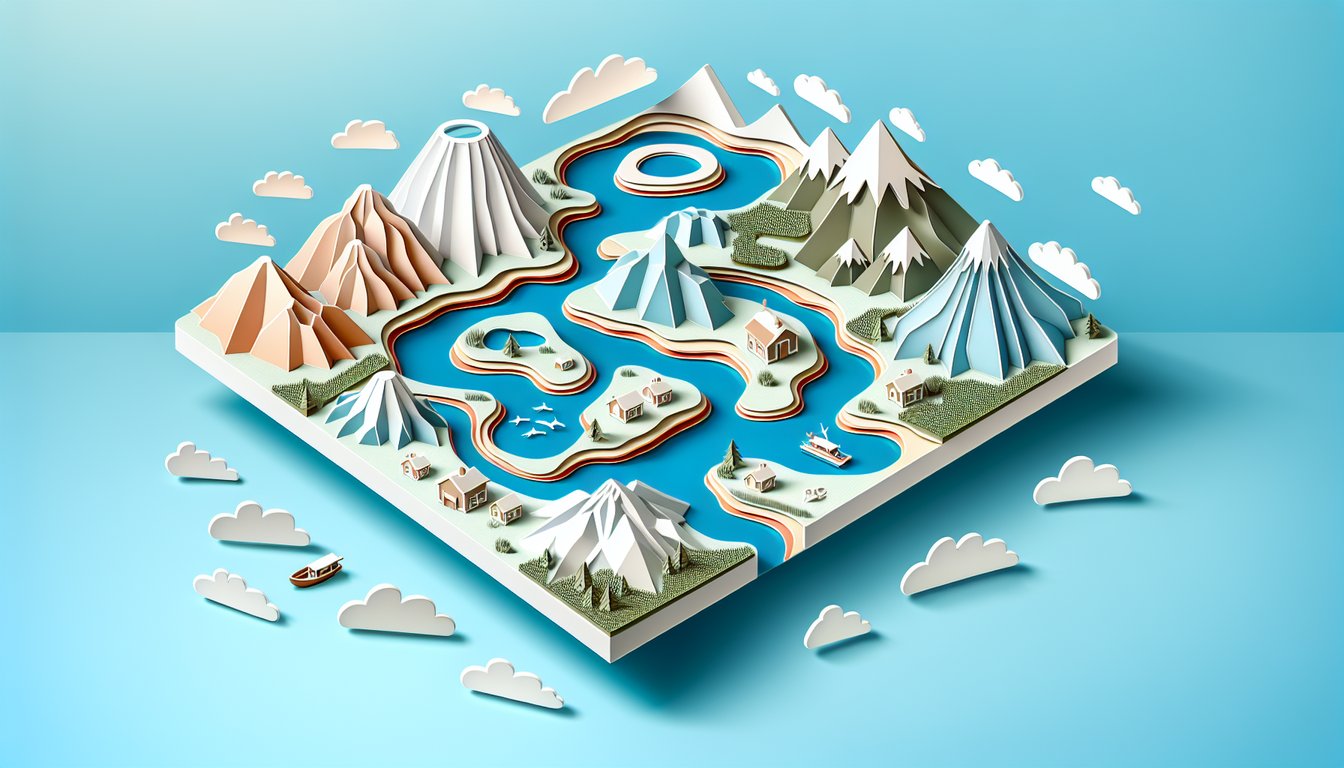
Curious about Earth's shapes? Our free, interactive and visually rich landforms quiz is designed for geography buffs eager to sharpen their knowledge of physical geography landforms. You'll test your grasp of landform features and challenge yourself on types of landforms, from oxbow lake formation to natural levee definition. Think you know your glacial moraine examples? Dive into this engaging challenge - spot mountains, valleys, landforms water bodies, and more. Perfect for students and explorers alike, this quiz offers instant feedback, scores, and fun facts to help you learn. Take the quiz now and prove you know every contour of our planet!
Which landform is formed by the accumulation of sediments at a river's mouth?
Floodplain
Levee
Alluvial fan
Delta
A delta forms when a river carries sediment into a standing body of water and loses energy, depositing its load at the mouth and building out into a characteristic triangular shape. This accumulation of sediments differentiates deltas from other depositional landforms. More info.
What is a natural levee?
A curved lake cut off from a river
An elevated ridge alongside a river channel
A broad, flat area that floods
A triangular deposit at a river mouth
Natural levees form when rivers flood and deposit coarser sediments close to the channel banks, creating raised embankments. These ridges help confine subsequent flows. More info.
What is a floodplain?
A broad, flat area adjacent to a river that floods periodically
A steep valley carved by glaciers
A ridge formed by river sediment
A bowl-shaped depression in glacial terrain
Floodplains are flat areas next to rivers that flood when water overruns the banks. Periodic flooding deposits nutrient-rich silt, making floodplains fertile soils. More info.
Which feature is a crescent-shaped lake formed when a river meander is cut off?
Braided channel
Alluvial fan
Oxbow lake
Kettle lake
An oxbow lake forms when a river meander becomes so exaggerated that the neck of the loop is breached, isolating the bend. The river then takes a shorter course, leaving the curved lake behind. More info.
What is a mesa?
A narrow ridge of rock
An isolated flat-topped hill with steep sides
A large inland dune
A rounded hill
Mesas are elevated areas of land with a flat top and steep sides, typically formed by differential erosion of horizontal rock layers. The harder caprock resists weathering while underlying softer layers erode away. More info.
Which term describes a narrow strip of land connecting two larger landmasses?
Spit
Peninsula
Isthmus
Archipelago
An isthmus is a narrow land bridge that connects two larger land areas and separates two bodies of water. Isthmuses are strategic landforms for human transportation and migration. More info.
What is a peninsula?
A chain of islands
A submerged sandbar
A piece of land surrounded by water on three sides
A narrow land connection between two areas
A peninsula is land largely surrounded by water but connected to a mainland on one side. Common examples include Florida in the USA and the Iberian Peninsula. More info.
Which landform is a broad, flat elevated area with a steep drop?
Plateau
Canyon
Dune
Valley
Plateaus are flat-topped highlands that have been uplifted or formed by erosion-resistant rock layers. Rivers often carve deep canyons into their edges. More info.
What is a canyon?
A deep valley with steep sides carved by a river
A river deposit plain
A flat expanse of rock
A coastal cliff
Canyons form over geologic time as rivers cut down through rock layers, creating steep, narrow valleys. The Grand Canyon is a classic example. More info.
Which term refers to a low area of land between hills or mountains?
Valley
Mesa
Butte
Dune
Valleys are elongated depressions typically formed by river erosion or glacial activity. They provide natural routes for rivers and human transportation. More info.
What is an archipelago?
A volcanic cone
A submerged ridge
A narrow channel
A group or chain of islands
An archipelago is a collection of islands clustered in a sea or ocean. Famous examples include Indonesia and the Philippines. More info.
Which landform is a fertile spot in a desert where water is found?
Dune
Bajada
Oasis
Playground
Oases occur where groundwater reaches the surface in arid regions, creating isolated areas of water and vegetation. They have historically been vital for caravan routes. More info.
What is a dune?
A rocky mound
A hill of wind-blown sand
A coastal spit
An eroded valley
Dunes form where wind transports and deposits sand grains, creating mounds or ridges. They are common in deserts and along sandy coastlines. More info.
Which feature is a gently sloping shore of sand or pebbles?
Cliff
Beach
Spit
Bar
Beaches are formed by wave action depositing sand, pebbles, or cobbles along coastlines and lake shores, creating sloping surfaces. They often shift with storms and tides. More info.
What is a cliff?
A steep rock face or escarpment
A small island
A flat plain
A sandbar
Cliffs form where resistant rock layers are exposed to erosion, often along coastlines or river valleys. The vertical or near-vertical faces result from weathering and mass wasting. More info.
What depositional feature forms at the base of mountain valleys by water flowing out and losing energy?
Levee
Alluvial fan
Kettle lake
Delta
Alluvial fans form where high-gradient streams exit narrow valleys onto flat plains, depositing sediments in a fan shape as flow velocity decreases. They are common in arid and semi-arid regions. More info.
Which isolated, steep-sided hill with a small, flat top is smaller than a mesa?
Butress
Plateau
Mesa
Butte
Buttes are smaller flat-topped hills with steep sides, formed from erosional remnants of plateaus or mesas. Their caprock protects underlying softer rock from erosion. More info.
What is an esker?
A sinuous ridge of sand and gravel deposited by subglacial streams
A glacially carved valley
A bowl-shaped depression left by melting ice
A type of moraine at a glacier's terminus
Eskers form in tunnels beneath glaciers where meltwater deposits sediments in long, winding ridges after the ice melts away. They indicate past subglacial drainage patterns. More info.
Which streamlined hill composed of glacial till indicates former ice flow direction?
Horn
Kettle
Drumlin
Cirque
Drumlins are smooth, elongated hills formed beneath glaciers, aligned parallel to ice flow, indicating the glacier's movement. Their tapered end points downstream. More info.
What is a kettle lake?
A narrow inlet of the sea between cliffs
A depression formed by melting ice blocks and filled with water
A ridge of sediment beside a river
A glacially carved bowl at a mountain head
Kettles form when ice blocks buried in glacial till melt, leaving depressions that fill with water. They are typically irregular in shape and size. More info.
Which amphitheater-shaped basin is carved into mountains by glacial erosion?
Cirque
Col
Arête
Horn
Cirques are bowl-shaped hollows carved by glacier headwalls, often where glaciation begins. They can form tarn lakes after ice melts. More info.
What is an arête?
A sharp, narrow ridge formed between two glacial valleys
A coastal spit
A triangular delta lobe
A flat upland
Arêtes form where two adjacent glaciers carve parallel valleys, leaving a thin, serrated ridge between them. They are classic glacial ridges. More info.
Which pyramidal peak results from multiple cirques eroding a mountain summit?
Moraine
Nunatak
Horn
Tarn
Horns are sharp, pyramid-shaped peaks formed as several cirque glaciers erode a mountain from different sides. The Matterhorn is a famous example. More info.
What is a spit?
A submerged sandbar offshore
A narrow landform of sand or gravel projecting from the coast
An island formed on a river
A mountain pass
Spits form where longshore drift deposits sediment in open water, creating elongated ridges attached to the mainland at one end. They often enclose lagoons. More info.
Which narrow, offshore island parallel to the coastline is built by wave action?
Barrier island
Deltaic island
Tombolo
Atoll
Barrier islands are long, narrow sand islands formed by accumulation of offshore sediments, protecting the coast from waves and storms. They often shift over time. More info.
What is a baymouth bar?
A sandbar that completely crosses a bay, sealing it off
A coastal cliff
A ridge of glacial till inland
A rocky headland
Baymouth bars form when longshore drift deposits sand across a bay's mouth, potentially cutting it off from the open sea. This may create a lagoon behind the bar. More info.
Which shallow body of water separated from the ocean by a spit or barrier island is called?
Estuary
Marsh
Fjord
Lagoon
Lagoons are shallow coastal water bodies separated from the ocean by barrier islands or spits. They often have restricted tidal exchange. More info.
What is a tombolo?
An eroded cliff base
A submerged coral reef
A sand or gravel bar that connects an island to the mainland
A flooded river valley
Tombolos form when wave refraction and deposition build a bar linking an island to the mainland. They reflect complex sediment transport. More info.
Which flat-bottom depression in arid regions forms when water evaporates after heavy rain?
Playa
Alluvial fan
Oxbow lake
Butte
Playas are ephemeral lakes in desert basins that dry out and leave flat, salty surfaces. When filled, they become shallow lakes. More info.
What is a cuesta?
A gently sloping rock layer fronted by a steep scarp
A sharp ridge between glaciers
A basin filled with glacial till
A deep U-shaped valley
Cuestas form where tilted sedimentary strata create asymmetrical ridges, with a gentle dip slope on one side and a steep scarp on the other. More info.
Which depression forms in soluble rock terrain when underground cavities collapse?
Polje
Sinkhole
Karst tower
Yardang
Sinkholes develop in karst areas where limestone or other soluble rocks dissolve, creating voids that eventually collapse. They can form abruptly and vary widely in size. More info.
What is a karst tower?
A glacial moraine
A steep, isolated hill of limestone in karst regions
A sand ridge in desert
A volcanic plug
Karst towers are residual limestone hills left standing as surrounding rock is dissolved away. They are common in humid, tropical karst landscapes like Guilin, China. More info.
Which large, flat-floored depression in karst areas can be several kilometers wide?
Mesa
Cirque
Playground
Polje
Poljes are extensive closed karst basins with flat floors often drained by swallow holes. They can host seasonal lakes and fertile soils. More info.
What is a yardang?
A coastal spit
A river terrace
A glacial drumlin
An elongated wind-eroded ridge in arid regions
Yardangs form where strong prevailing winds erode softer materials around harder rock, creating streamlined ridges aligned with wind direction. Common in deserts. More info.
Which isolated rock hill rising abruptly in a plain is called?
Spit
Inselberg
Tombolo
Cirque
Inselbergs are isolated rock hills or mountains that remain after long-term erosion removed surrounding softer rocks. They stand prominently in flat terrains. More info.
What is a pingo?
A conical mound of ice covered by soil in permafrost regions
A coastal sand dune
A glacial cirque
A karst tower
Pingos form in permafrost when groundwater freezes and expands, pushing up overlying sediments. They can collapse when interior ice melts. More info.
Which landform results from thawing of permafrost creating uneven ground?
Mesa
Thermokarst
Yardang
Inselberg
Thermokarst landscapes form where melting permafrost causes ground subsidence and irregular surfaces with ponds and mounds. More info.
What is a blowout dune?
A depositional ridge of gravel
A submerged valley
A eroded limestone pillar
A hollow created by wind eroding sand from a dune
Blowouts are depressions in sand dunes where wind removes sediment, often due to vegetation loss. They can enlarge over time. More info.
Which small cave-like feature forms in rock faces due to salt weathering?
Karst tower
Mesa
Tafoni
Cirque
Tafoni are honeycomb-like cavities in coastal and desert rocks formed by salt crystallization and moisture cycles. More info.
What is a pedestal rock?
A glacial erratic
A rock mass balanced on a narrow base due to wind erosion
A coastal stack
A fluvial terrace
Pedestal rocks, or mushroom rocks, form when wind-blown sand erodes the lower portion of a rock more than the upper, creating a narrowed base. More info.
Which feature represents an ancient beach elevated above current sea level?
Raised beach
Blowout
Spit
Barrier island
Raised beaches form when land uplifts or sea level falls, leaving former shorelines stranded above present sea level. They often have wave-cut terraces. More info.
What is a fluvial terrace?
A step-like landform alongside a river formed by previous floodplain levels
A volcanic plateau
A glacial moraine
A coastal platform
Fluvial terraces form as rivers incise into their own floodplains, leaving former floodplain surfaces as step-like benches. They record past river levels. More info.
Which asymmetric rocky hill yields evidence of past glacial abrasion on its stoss side?
Inselberg
Yardang
Roche moutonnée
Drumlin
Roche moutonnées are bedrock knobs sculpted by glacier movement, with a smooth, gently sloping stoss side and a rough, plucked lee side. They indicate ice flow direction. More info.
What is a megafan?
A chain of eskers
A broad floodplain
A giant dune field
A very large alluvial fan formed by major river systems
Megafans are immense alluvial fans spanning tens to hundreds of kilometers, formed by large rivers depositing sediment as flows spread out onto plains. Examples include the Kosi megafan in India. More info.
Which depositional feature develops when multiple alluvial fans coalesce along a mountain front?
Alluvial plain
Delta
Megafan
Bajada
Bajadas form where adjacent alluvial fans merge into a continuous slope at the base of mountain ranges, common in arid environments. More info.
What is patterned ground?
Wave-cut platforms
Stream-carved channels
Wind-sculpted ridges
Regularly spaced circles, polygons or stripes in periglacial areas
Patterned ground forms in cold climates when freeze-thaw cycles sort particles into polygons or stripes, common in tundra regions. More info.
Which zone of unfrozen ground within permafrost prevents upward migration of water?
Pingo
Pingolike
Talik
Thermokarst
Taliks are unfrozen ground layers within or below permafrost, influencing hydrology and ground stability in cold regions. More info.
What is a paleochannel?
An ancient, buried river channel preserved in sedimentary deposits
A modern braided river system
A glacial meltwater tunnel
A coastal inlet
Paleochannels are former river or stream beds now filled or buried by younger sediments, important for groundwater exploration. More info.
0
{"name":"Which landform is formed by the accumulation of sediments at a river's mouth?", "url":"https://www.quiz-maker.com/QPREVIEW","txt":"Which landform is formed by the accumulation of sediments at a river's mouth?, What is a natural levee?, What is a floodplain?","img":"https://www.quiz-maker.com/3012/images/ogquiz.png"}
Score9/48
Easy1/15
Medium4/15
Hard3/12
Expert1/6
AI Study Notes
Email these to me
You can bookmark this page to review your notes in future, or fill out the email box below to email them to yourself.
Study Outcomes
Understand Physical Geography Landforms -
Describe the characteristics of physical geography landforms and their roles in shaping Earth's surface processes.
Define Natural Levees -
Explain the natural levee definition and how these riverbank landform features form through sediment deposition.
Analyze Oxbow Lake Formation -
Understand the stages of oxbow lake formation and identify key processes involved in river meander cutoff.
Identify Glacial Moraine Examples -
Recognize and categorize glacial moraine examples to illustrate the diversity of glacier-formed landforms.
Differentiate Types of Landforms -
Distinguish between various types of landforms by comparing their defining features and formation mechanisms.
Cheat Sheet
Natural Levees -
Natural levees are raised embankments built from coarse sediment deposited at river banks during floods, embodying a key physical geography landform feature (USGS). These depositional types of landforms form when floodwaters slow at channel margins and drop heavier particles first. Memory trick: think "Levee = Leave high and dry" to recall its protective ridge.
Oxbow Lake Formation -
Oxbow lakes form when meandering rivers cut through narrow necks of their own bends, isolating a crescent”shaped water body (University of Cambridge). This classic landform feature illustrates erosion on outer banks and deposition on inner banks until cutoff occurs. Picture an ox's yoke to remember the curved shape post”cutoff.
Glacial Moraine Examples -
Glacial moraines are accumulations of till deposited along or at the end of ice glaciers; examples include terminal moraines on Long Island (NOAA) and lateral moraines in the Alps. Types of landforms such as medial, lateral, terminal, and ground moraines mark glacier movement and melting patterns. Try the mnemonic "LLTG" for lateral, lateral, terminal, ground to sort moraine types.
Deltas vs. Alluvial Fans -
Deltas and alluvial fans are depositional landforms that differ by sediment size and water velocity: deltas form in standing bodies of water like seas, while alluvial fans spread coarser detritus at mountain outlets (National Geographic). Comparing the Nile Delta and the Death Valley fan highlights how environment shapes these types of landforms. Mnemonic: "Delta = Deep water, Fan = Flat land".
Karst Landform Features -
Karst landscapes develop by the dissolution of soluble rocks like limestone, creating sinkholes, caves, and underground streams as seen in Mammoth Cave (National Park Service). Recognizing karst topography is vital in physical geography landforms due to its aquifer impact and unique surface features. To recall karst traits, remember "K-A-R-S-T: Karst Always Reveals Subterranean Tunnels".