Unlock hundreds more features
Save your Quiz to the Dashboard
View and Export Results
Use AI to Create Quizzes and Analyse Results

Sign inSign in with Facebook
Sign inSign in with Google
Quizzes > High School Quizzes > Social Studies

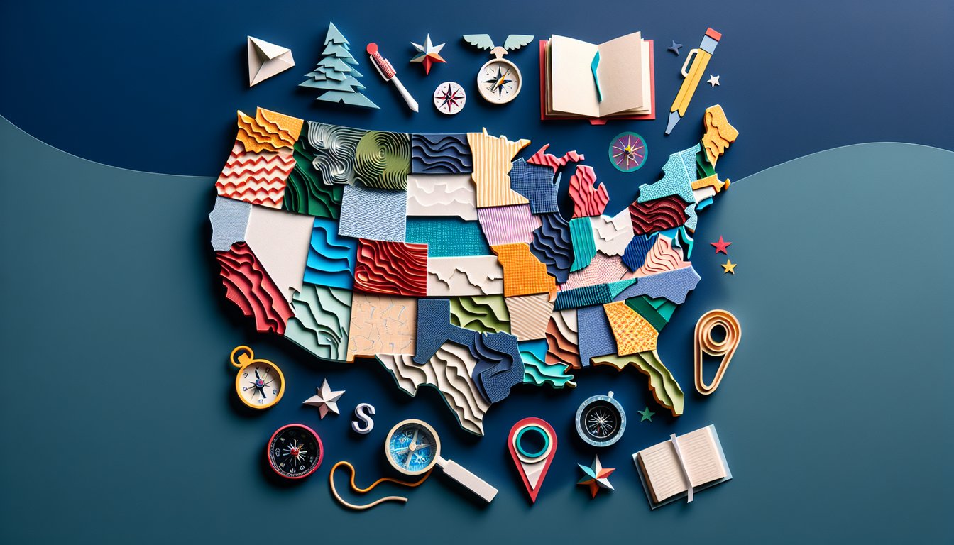
Ace the US Map Test Practice Quiz

Boost your US geography skills with practice

Difficulty: Moderate
Grade: Grade 5
Study OutcomesCheat Sheet
Paper art depicting USA map for a geography trivia quiz challenge for students.

Which U.S. state is nicknamed the 'Sunshine State'?
Florida
California
Arizona
Nevada
Florida is widely known as the 'Sunshine State' due to its warm and sunny weather. This nickname is reflected in both cultural references and map-based educational tools.
Which state is colloquially referred to as 'The Mitten'?
Wisconsin
Indiana
Michigan
Illinois
Michigan's Lower Peninsula is famously shaped like a mitten, making it a unique and easily recognizable feature on U.S. maps. This distinctive outline helps students quickly identify the state.
Which state is located in the Pacific Northwest region of the United States?
Texas
New York
Washington
Florida
Washington is a key state in the Pacific Northwest, known for its coastal location and evergreen forests. Its geographic placement is clearly depicted on U.S. maps.
Which state is known as the 'Lone Star State'?
Colorado
Nevada
California
Texas
Texas is famously nicknamed the 'Lone Star State' as a nod to its history as an independent republic. This moniker is commonly illustrated on maps and in geographic studies.
Which of the following states is recognized by its panhandle shape in the northwestern part of the state?
Indiana
Oklahoma
Kansas
Nebraska
Oklahoma is distinguished by its panhandle, a narrow strip of land that sets it apart on U.S. maps. Recognizing such unique state shapes is essential for mastering U.S. geography.
Which state is part of the New England region?
Georgia
Ohio
Massachusetts
Texas
Massachusetts is one of the six states that make up the New England region, known for its rich colonial history. Its location in the northeastern United States is clearly shown on standardized maps.
Which state is directly north of Texas?
Arkansas
New Mexico
Kansas
Oklahoma
Oklahoma lies directly to the north of Texas, making it an important reference point on U.S. maps. Recognizing neighboring states helps in understanding regional geography.
Which state features the Front Range in the Rocky Mountains as well as expansive High Plains?
Colorado
Nevada
Wyoming
Utah
Colorado is renowned for its dramatic geography that includes the Front Range of the Rocky Mountains and the wide-open High Plains. These contrasting terrains are well-depicted on U.S. maps.
Which state is bordered by eight other U.S. states?
Tennessee
Colorado
Oregon
Maine
Tennessee is notable for its numerous land borders, sharing boundaries with eight states. This high number of adjacent states is a unique geographic feature important in U.S. map studies.
Which state is composed of two distinct peninsulas?
Florida
Virginia
Michigan
South Carolina
Michigan is unique in that it consists of the Upper and Lower Peninsulas, a feature that makes it stand out on any U.S. map. This distinctive layout plays an important role in regional geographic identification.
Which state is located entirely on an island?
Hawaii
Alaska
Rhode Island
New York
Hawaii is the only U.S. state that is completely an archipelago, composed entirely of islands in the central Pacific. This isolation and island formation is a key element in its geographic identity.
Which U.S. region includes states like New York, New Jersey, and Pennsylvania?
The Pacific Northwest
The Southeast
The Mid-Atlantic region
The Southwest
The Mid-Atlantic region is defined by states such as New York, New Jersey, and Pennsylvania, all of which share historical and geographical ties. This regional grouping is a common focus in map-based geography studies.
Which of the following states does not have any land borders with Canada?
New York
Michigan
Florida
Minnesota
Florida is located in the southeastern United States and does not share a land border with Canada, unlike many northern states. This characteristic makes it distinct on geopolitical maps.
Which state is one of the four that meet at the Four Corners region?
New Mexico
Utah
Arizona
Nevada
Arizona is one of the four states - along with Utah, New Mexico, and Colorado - that converge at the Four Corners point. This unique geographical landmark is a frequent subject of map challenges and quizzes.
Which of the following states is a Midwestern state known for its manufacturing and agriculture?
Nevada
New Mexico
Ohio
Florida
Ohio is a staple of the Midwest, known for its robust manufacturing sector and expansive agricultural lands. Its economic and geographic profile is clearly depicted on regional maps.
Which state has the most diverse range of climates, from arid deserts to alpine conditions?
Utah
Nevada
Oregon
California
California exhibits an impressive array of climates including coastal Mediterranean, desert, and alpine conditions in the Sierra Nevada. This climatic variety is prominently displayed on detailed U.S. maps.
Which state is characterized by a highly irregular coastline with numerous bays and inlets?
Colorado
Kansas
Maine
New Mexico
Maine's coastline is notably complex, featuring a myriad of bays, peninsulas, and inlets. This irregular pattern poses challenges for cartographers and is a prominent feature on regional maps.
Which state, despite its relatively small size, has one of the highest population densities in the U.S.?
Montana
Wyoming
New Jersey
Alaska
New Jersey is one of the smallest U.S. states by area but boasts a very high population density. This concentration of urban and suburban areas is clearly illustrated in demographic maps.
Which state's capital is located significantly inland rather than on a coastal or border area?
California
Arizona
Florida
Maine
Arizona's capital, Phoenix, is situated well inland, a contrast to many state capitals that are found along coasts or borders. This inland location helps distinguish Arizona on various map representations.
Which state's geographic boundary is largely defined by a major river?
Vermont
Mississippi
Oregon
Idaho
The state of Mississippi derives a significant portion of its boundary from the mighty Mississippi River. This natural demarcation creates unique cartographic challenges and is a key detail on U.S. maps.
0
{"name":"Which U.S. state is nicknamed the 'Sunshine State'?", "url":"https://www.quiz-maker.com/QPREVIEW","txt":"Which U.S. state is nicknamed the 'Sunshine State'?, Which state is colloquially referred to as 'The Mitten'?, Which state is located in the Pacific Northwest region of the United States?","img":"https://www.quiz-maker.com/3012/images/ogquiz.png"}

Study Outcomes

  1. Identify and locate U.S. states and regions on a map.
  2. Analyze spatial relationships and geographic boundaries within the United States.
  3. Recall and recognize key features of U.S. geography during mapping challenges.
  4. Apply map reading strategies to enhance overall U.S. geographical comprehension.

US Map Test Practice Cheat Sheet

  1. Master the 50 States - Challenge yourself to memorize the shape and location of all 50 U.S. states for lightning-fast map identification. This interactive quiz pops up outlines and asks for state names, turning study time into a high-score game. Keep practicing and watch your recognition skills shoot through the roof! Try the Sporcle States Quiz
  2. Get to Know the 5 Major Regions - Break the country into bite-sized territory by learning the Northeast, Southeast, Midwest, Southwest, and West divisions. Understanding these regions helps you predict climate, culture, and cuisine before you even set foot there. Use this interactive guide to explore each region's unique vibe and landmarks. Explore U.S. Regions on EducaPlay
  3. Learn Every State Capital - Boost your geography prowess by memorizing each state's capital city - the unsung hero of American maps. This engaging quiz pits you against the clock to match capitals to states before time runs out. Nail these names and impress your friends (or your professor) in one smooth sweep! Take the State Capitals Quiz
  4. Master Absolute Location - Get precise with latitude and longitude coordinates to pinpoint any spot on Earth down to the minute. Knowing absolute location lays the groundwork for advanced map reading and GPS navigation. Dive into the five themes of geography to see how this concept shapes your global perspective. Read About Absolute Location
  5. Understand Relative Location - Describe a place by referencing nearby landmarks, states, or natural features - think "north of the Great Lakes" or "west of the Mississippi." Grasping relative location helps you orient maps and gives context to historical events. Practice explaining locations to friends and watch your spatial vocabulary expand. Explore Relative Location
  6. Spot Major Physical Features - Identify the Appalachian Mountains, Great Plains, Mississippi River, and more to appreciate the U.S. landscape's drama. Recognizing these landmarks connects you to geology, climate, and settlement patterns across the country. Test yourself with this map challenge and see if you can name every feature! Try the Physical Features Quiz
  7. Draw State Boundaries from Memory - Put pen to paper (or stylus to screen) and sketch state outlines to lock shapes into your brain. This exercise strengthens your hand-eye spatial skills and reveals which state silhouettes need extra attention. Turn each attempt into a friendly competition by timing yourself and tracking your improvement. Start the Map Drawing Challenge
  8. Dive into Regional Culture & Economics - Go beyond borders to explore what makes each U.S. region tick: southern hospitality, midwestern agriculture, western tech hubs, and more. Understanding cultural and economic traits gives you a richer story behind the maps. Flip through these flashcards to see how history and industry shape each area. View Regional Flashcards
  9. Play Interactive Map Quizzes - Level up your study sessions with games that challenge you to locate states at warp speed. Instant feedback lets you correct mistakes on the fly and cements your knowledge in record time. Mix and match quizzes for variety, and turn studying into your new favorite pastime. Play the U.S. States Quiz
  10. Review the Five Themes of Geography - Cement your understanding by exploring Location, Place, Human - Environment Interaction, Movement, and Region. This framework ties together everything you've learned about maps, societies, and ecosystems. Revisit these themes often to see how they weave into every corner of geography. Learn the Five Themes
Powered by: Quiz Maker