Unlock hundreds more features
Save your Quiz to the Dashboard
View and Export Results
Use AI to Create Quizzes and Analyse Results

Sign inSign in with Facebook
Sign inSign in with Google
Quizzes > High School Quizzes > Social Studies

Topographic Map Reading Practice Quiz

Enhance your skills with interactive map exercises

Difficulty: Moderate
Grade: Grade 7
Study OutcomesCheat Sheet
Paper art illustrating a trivia quiz on topographic trail challenge for high school students.

What do contour lines on a topographic map represent?
Roadways and paths
Weather patterns
Political boundaries
Elevation lines that connect points of equal altitude
Contour lines on a topographic map connect points that have the same elevation, helping to visualize the three-dimensional shape of the terrain. They are essential for understanding elevation changes and landform shapes.
On a topographic map, widely spaced contour lines indicate what type of slope?
A steep slope
A cliff
Flat land
A gentle slope
Widely spaced contour lines reflect gradual elevation changes, which correspond to gentle slopes. Conversely, closely spaced lines would indicate steep terrain.
What map feature is typically used to show a hill on a topographic map?
Parallel contour lines
Dashed lines
A series of closed, concentric contour lines
Color gradients
A hill is represented by a set of closed, concentric contour lines with increasing elevation toward the center. This pattern clearly indicates a raised landform.
Which symbol on a topographic map usually represents water bodies such as lakes and rivers?
Red symbols
Green shaded areas
Brown contour lines
Blue color fill
Water bodies on topographic maps are typically shown in blue, a universal color used to denote rivers, lakes, and streams. This visual cue helps distinguish water features from other land elements.
What does a topographic map provide that a typical road map does not?
Elevation and terrain details
Street names and urban details
Public transportation routes
Highway exit numbers
Topographic maps include detailed information about the terrain and elevation changes, representing the three-dimensional aspect of the landscape. In contrast, road maps focus primarily on streets, highways, and urban infrastructure.
How can the steepness of a slope be determined from a topographic map?
By observing the spacing between contour lines
By counting the number of landmarks
By the color density of the map
By measuring the distance between road symbols
The steepness of a slope is determined by the spacing between contour lines; closely spaced lines indicate steepness, while widely spaced lines imply a gentle incline. This method provides a visual representation of elevation change over distance.
If contour lines are very close together, what does that typically indicate about the terrain?
The area is a water body
The terrain is steep
There is abundant vegetation
The terrain is flat
Very close contour lines signal rapid changes in elevation over a short distance, indicating steep terrain. Understanding this helps in assessing the difficulty of navigating the area.
What do spot elevations on a topographic map represent?
The lowest elevation in a valley
Elevation trends across a region
Exact elevation at a specific point
The average elevation of an area
Spot elevations give the precise altitude of specific points on the map, providing key information about the terrain at that location. This detail is critical for accurate navigation and landscape analysis.
Which of these topographic features is indicated by a 'V' shape on a contour map?
A mountain peak
A plateau
A river valley
A flat plain
A 'V' shape in contour lines typically indicates a river valley, with the point of the V often pointing upstream. This formation helps to infer the drainage direction and the nature of the landform.
What does the term 'isoline' refer to on a topographic map?
A boundary between regions
A line following road networks
A line connecting points of equal elevation
A marker for vegetation zones
An isoline is a line drawn on a map connecting points that share the same value, such as elevation. This concept is key in topography for visualizing the contour of the terrain.
When planning a hiking route, why is it important to analyze contour lines on a topographic map?
They indicate locations of historical landmarks
They show real-time weather patterns
They reveal the steepness and difficulty of the terrain
They provide information on road conditions
Analyzing contour lines allows hikers to identify steep or challenging sections of a trail by revealing elevation changes. This information is crucial for planning safe and manageable routes.
Which contour pattern might indicate a depression or sinkhole?
Closed contours with hachure marks pointing inward
Straight, uninterrupted contours
Randomly broken lines
Distant parallel lines
A depression or sinkhole is typically depicted by closed contour lines with hachure marks directed toward the depressed area. This pattern distinguishes it from isolated hills or other features.
How does a topographic map convey the direction of a river's flow?
By the map's scale
By the thickness of the river's color
By the location of bridge symbols
By the shape and orientation of the contour lines forming a 'V'
The 'V' shape formed by contour lines near a river typically indicates the direction of water flow, with the point of the V facing upstream. This method helps users understand drainage patterns without explicit arrows.
What is the importance of the map's scale in a topographic map?
It shows the date the map was drawn
It determines the relationship between map distances and real-world distances
It highlights the most important landmarks
It indicates the quality of the paper used
The scale is fundamental because it allows users to convert distances on the map to actual ground distances. This conversion is essential for planning, navigation, and accurately interpreting map features.
What distinguishes a contour map from a satellite image?
A contour map represents elevation through lines, while a satellite image shows actual photographs
A contour map displays political boundaries
A contour map provides weather patterns
A contour map is always in black and white
A contour map simplifies the terrain into lines that represent equal elevations, focusing solely on the topography. In contrast, a satellite image offers a realistic, photo-based view of the Earth's surface without explicitly indicating elevation changes.
When interpreting topographic maps, how can you determine the relative steepness of a slope using contour interval?
By counting symbols for vegetation
By analyzing the color variations
By measuring the width of contour lines
By comparing the contour interval with the distance between lines
The contour interval indicates the vertical distance between successive lines, and when combined with the horizontal distance between those lines, it allows the estimation of slope steepness. A small horizontal gap for a given contour interval signals a steep gradient.
How would you determine the drainage divide on a topographic map?
By finding clusters of water bodies
By locating areas with dense urban features
By examining color-coded vegetation zones
By identifying ridgelines where contour lines form a crest
A drainage divide is typically marked by a ridge or crest where water flows away in different directions, identifiable by the arrangement of contour lines. Recognizing these ridgelines helps in understanding watershed boundaries.
Which of the following best describes a saddle point on a topographic map?
A depressional basin
A low point between two higher elevations
The highest peak in an area
A linear ridge
A saddle point is a dip or low point found between two higher areas, often indicating a natural pass or route. This feature is important in identifying potential pathways through mountainous terrain.
Why is the understanding of contour curvature important in assessing potential landslide areas?
They reveal underground mineral deposits
They show the exact age of the land
They pinpoint the locations of trees
Concave and convex contours indicate differences in slope stability
The curvature of contours reveals how water may accumulate or shed from a slope; concave shapes can trap water and loose soil, while convex shapes generally promote runoff. This information is crucial for evaluating the risk of landslides in an area.
In advanced land survey techniques, how are topographic maps used to create three-dimensional models of terrain?
By combining contour data with digital elevation models
By using color gradients to estimate depth
By measuring only the horizontal distances between landmarks
By overlaying road networks onto satellite images
Topographic maps provide essential contour information that, when integrated with digital elevation models, enables the construction of precise three-dimensional representations of the terrain. This process is fundamental in modern surveying and GIS analysis.
0
{"name":"What do contour lines on a topographic map represent?", "url":"https://www.quiz-maker.com/QPREVIEW","txt":"What do contour lines on a topographic map represent?, On a topographic map, widely spaced contour lines indicate what type of slope?, What map feature is typically used to show a hill on a topographic map?","img":"https://www.quiz-maker.com/3012/images/ogquiz.png"}

Study Outcomes

  1. Identify and describe key features of topographic maps such as contour lines, scale, legends, and symbols.
  2. Interpret elevation data from contour lines to determine terrain gradients and slopes.
  3. Analyze geographic features to assess potential routes and challenges on a topographic trail.
  4. Apply map-reading skills to solve real-world navigation and earth science problems.

Topographic Map Reading Worksheet Cheat Sheet

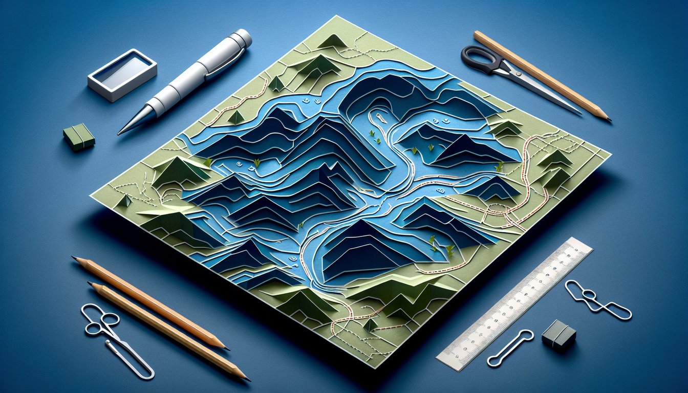
  1. Contour Lines and Elevation - Contour lines are your secret code to the shape of the land. When they huddle together, you're looking at a steep cliff or ridge; when they spread out, you've got a mellow slope underfoot. Perfect for planning whether you'll break a sweat or stroll in style! Hunter Ed: Reading a Topographic Map
  2. Landform Identification - Patterns in contour lines reveal hills, valleys, ridges, and depressions like a treasure map of terrain features. Spot concentric circles for hills, U‑shapes for ridges, and closed loops with tick marks for depressions. With practice, you'll name the landforms like a pro! CompassDude: Topographic Maps
  3. Streams and "V" Shapes - Contour lines bend into "V" shapes when they cross streams or rivers, pointing upstream like tiny arrows. This nifty clue shows you the water's uphill source and the valley's orientation. Use it to plan crossings and soak up the scenic river spots! CompassDude: Topographic Maps
  4. Scale Yourself! - The map's scale is like a translator between inches and real‑world miles or feet. On a 1:24,000 map, one inch on paper equals 2,000 feet on the ground, so measure with confidence. It's your best buddy for timing hikes and estimating fuel stops! CompassDude: Topographic Maps
  5. Legend Detective Work - The legend is your decoder ring for map symbols like trails, roads, campsites, and water features. Become a symbol sleuth to navigate like a seasoned explorer. No mysterious icons lurking when you know the legend inside out! CompassDude: Topographic Maps
  6. Contour Intervals Mean Business - The contour interval tells you the vertical spacing between lines, so you can gauge how high you'll climb or descend. A 20‑foot interval means each line jump equals 20 feet of uphill or downhill. Perfect info for planning rest stops and snacks! Hunter Ed: Reading a Topographic Map
  7. Align with North - Learning to orient your map with a compass ensures the north arrow on paper and in real life match up. Rotate the map until true north lines up and your bearings will be spot‑on for the trail. Say goodbye to wandering off‑course! CompassDude: Topographic Maps
  8. Index Contours to the Rescue - Look for the darker, numbered index contours; they're your trusty elevation milestones. These beefier lines pop out so you can quickly note the elevation without counting every thin line. It's like using highway exits instead of every street address! CompassDude: Topographic Maps
  9. Man-Made Symbols 101 - Buildings, bridges, and roads all have their own symbols on the map, so you'll never mistake a cabin for a boulder. Spotting these human‑made features boosts your situational awareness and keeps you on the right path. It's the difference between a surprise find or an "Oops, I got lost" moment! CompassDude: Topographic Maps
  10. 3D Terrain Visualization - Imagine the map's lines popping off the page like a sculpted mountain model, and you'll navigate with intuition. Visualizing valleys and peaks helps you pick the easiest route and anticipate the uphill battles. Soon you'll see the world in glorious topographic 3D! CompassDude: Topographic Maps
Powered by: Quiz Maker